Worthing Cycle Forum

Search form

Main menu

  • Home
  • News
  • Events
  • Projects
  • Information
  • About

You are here

Home » Projects » Worthing Cycle Map

In This Section

  • Worthing Prom to Sea Lane
  • Cycle Parking
  • Worthing Cycle Map
    • Brighton & Hove cycle maps
    • Cardiff Cycle Map
    • Cheltenham Cycle Map
    • Cycling in West Sussex
    • Steyning Cycle Map
    • Surrey Cycle Guide
  • Funding
  • Documents
  • A24 Cycleway Findon - Washington
  • A27 Cycleway Lancing - Shoreham
  • Goring Crossways cycleways
  • Hall of Shame
  • Harrison Road, Worthing
  • More Accessible Bridge at Elm Grove for cyclists and the disabled
  • Potholes and Cyclists
  • Worthing Sustainable Transport Package
  • Worthing – Lancing, North of Railway
  • Worthing – Lancing, south of railway

Steyning Cycle Map

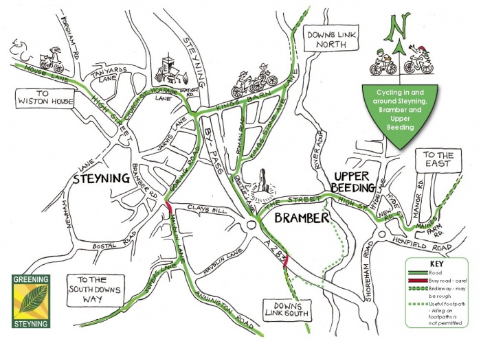
A pretty map, created by volunteers as part of the Steyning 10:10 Climate Action Campaign. Shows several routes through the town, with danger points marked in red.